Ancient Shipwrecks and 2,600 Years of History Discovered Beneath the Aegean Sea!
A fascinating underwater research project off the coasts of Karpathos and Kasos has uncovered an extraordinary concentration of historical remains, offering a window into more than 2,600 years of human activity.
The work, which began in 2019, is being led by Greece’s Ephorate of Underwater Antiquities in collaboration with the Institute of Historical Research, part of the National Research Foundation. Together, these teams have been steadily building a clearer picture of the region’s rich maritime past.
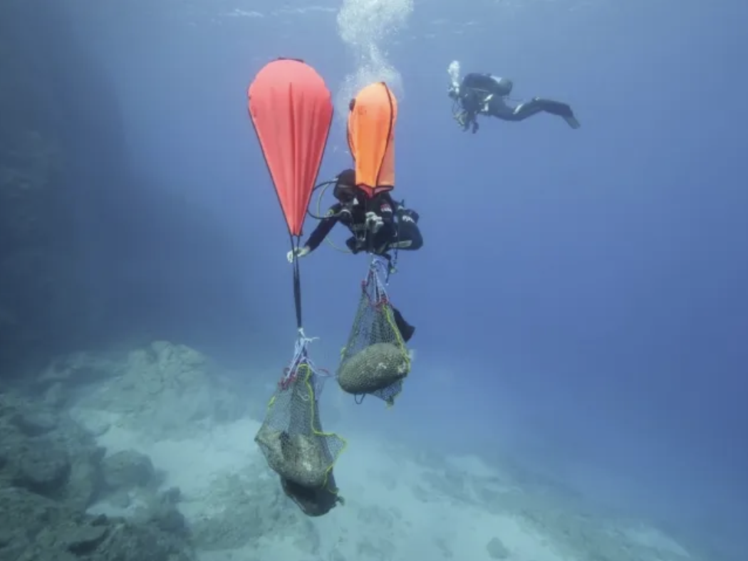
Photo Credit: E. Diamantis/Greek Ministry of Culture
Much of the exploration has focused on the waters around the ancient sites of Vrykountos and Nisyros. These were once part of a four-city grouping known as the “Karpathian tetrapolis”, a term used by the ancient geographer Strabo. Located in the south-eastern Aegean, Karpathos itself has deep historical roots, appearing in early Greek literature, including the works of Homer. According to myth, the island is linked to figures such as Iapetus and Proteus.
So far, researchers have completed more than 120 dives, exploring depths ranging from just 3 metres down to 45 metres. Their survey has covered northern Karpathos as well as the nearby island of Saria. What they’ve uncovered is nothing short of remarkable: an almost continuous record of human presence stretching from the late 7th century BC right through to the early 19th century.
Among the most striking discoveries are four ancient shipwrecks, along with a more recent wreck. These finds shed light on centuries of trade and seafaring, offering valuable clues about how goods and people moved across the region. In addition, the team has identified parts of merchant vessels, remnants of harbour structures, and more than twenty anchors dating back to the Byzantine period.
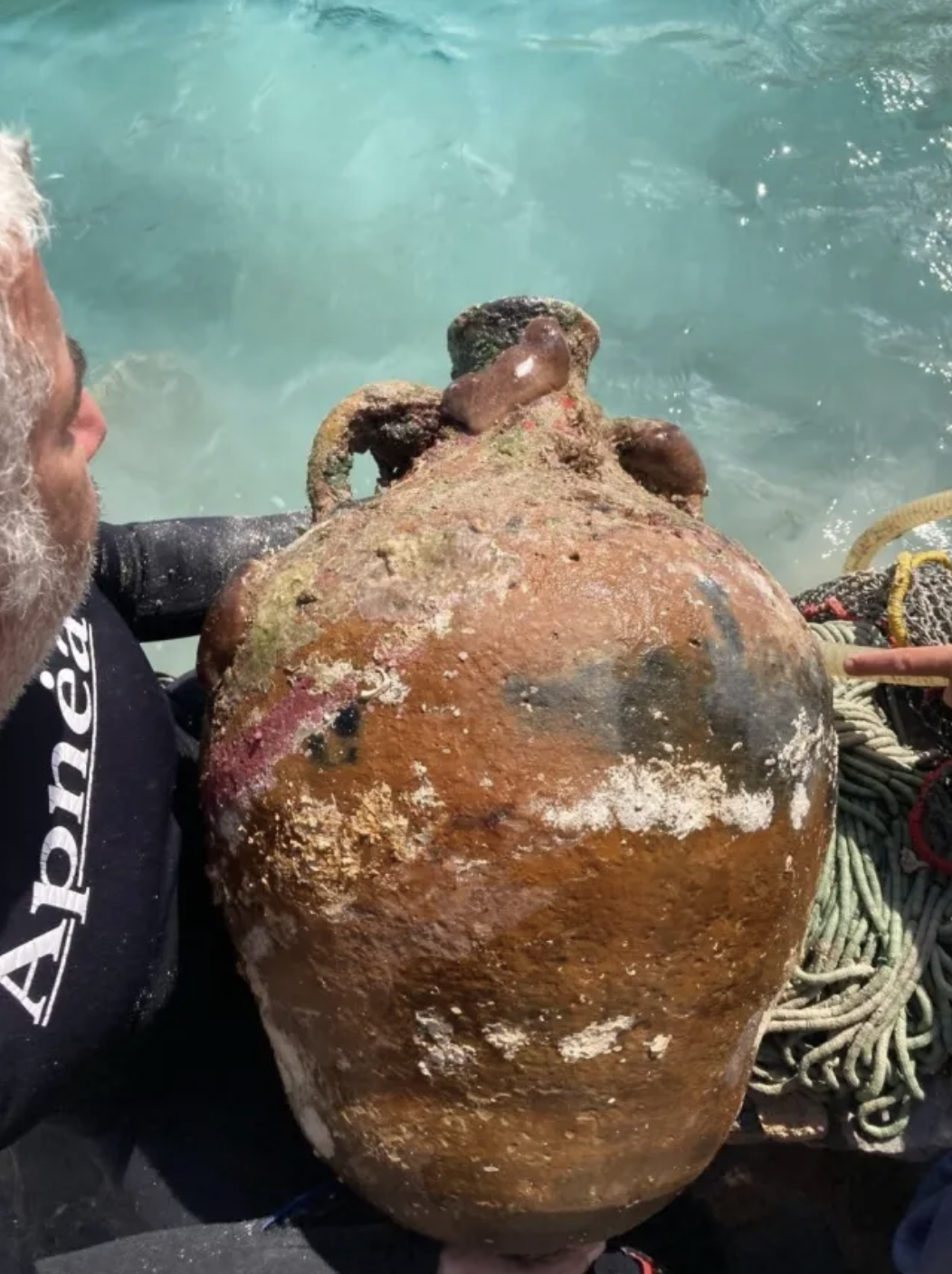
Photo Credit: E. Diamantis/Greek Ministry of Culture
When these underwater discoveries are considered alongside remains of homes and churches in the Tristomo area, a clear picture begins to emerge. This was not just a remote outpost, but a place of real importance, both as a commercial centre and a strategic location, particularly during Late Antiquity.
To document everything in detail, the team has relied on modern technology, including underwater photogrammetry and geospatial mapping. These tools allow researchers to create highly accurate digital records and reconstructions of the sites. In time, this could support further research, aid preservation efforts, and even make the sites accessible to the public through virtual experiences.
The project itself has been a truly international effort, bringing together more than forty specialists from a range of disciplines. Experts from organisations such as Mexico’s National Institute of Anthropological Research and the Norwegian Maritime Museum have contributed, underlining the global interest in the work.
Funding has come from a mix of public institutions and private organisations, including the General Secretariat for Aegean and Island Policy, the National Research Foundation, TERNA Energy, and the Baltic Exchange Charitable Foundation, alongside other supporters. Local authorities and institutions have also played a key role, providing essential technical and logistical backing.
All in all, this ongoing project is steadily revealing just how significant this corner of the Aegean has been across the centuries and how much there is still to learn beneath the surface.